

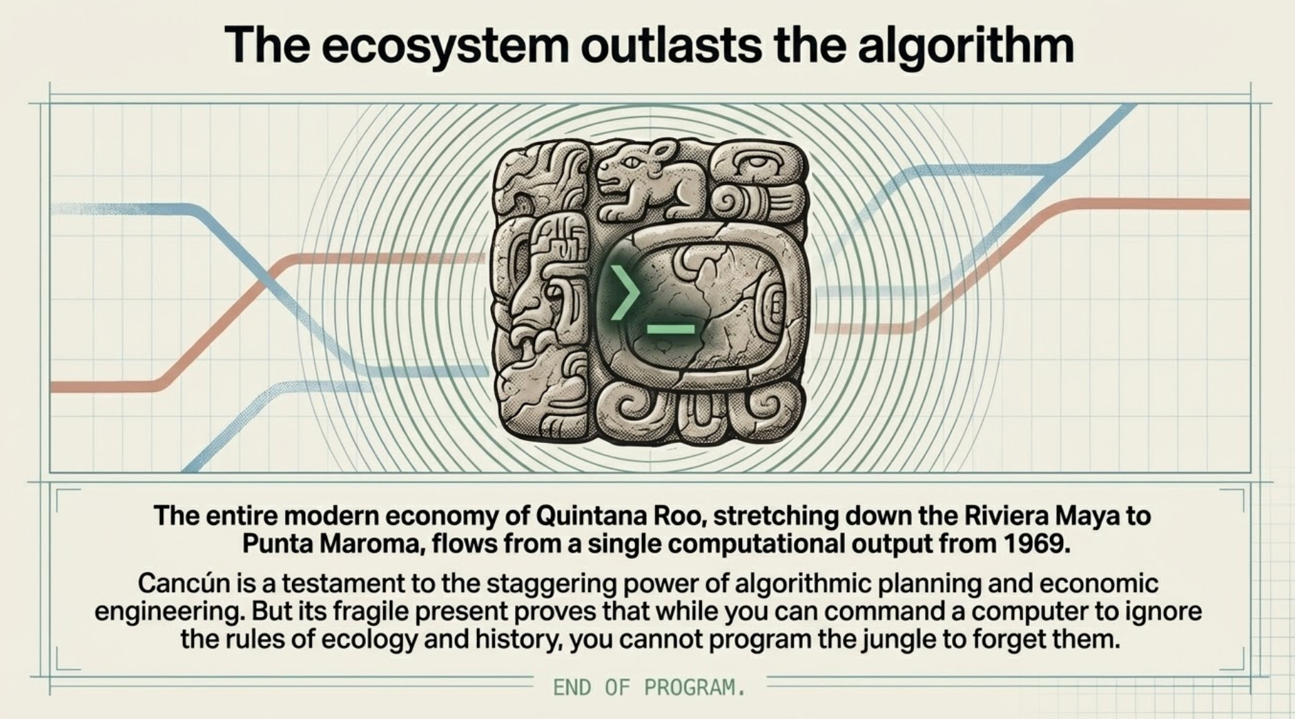
While You Can Command a Computer to Ignore the Rules of Ecology and History, You Cannot Program the Jungle to Forget Them
How a Single Stretch of Coastline Was Rewritten 5 Times in 2,000 Years

The Yucatan coastline looks like it was built last week. White sand, turquoise water, palms at the right angle. It suggests a blank slate. An environment designed for modern leisure, detached from any complex past. A place that simply appeared.
That is a fiction.
The landscape is never a blank slate. The physical land itself rarely changes, but the way human ambition collides with that geography goes through incredibly dramatic shifts. A coastline is never just a coastline.
I recently started thinking about how a single stretch of geography, specifically the area around modern-day Cancun and Punta Maroma, has been repeatedly overwritten. The true history of this coastline is a staggering 2,000-year saga. It is a story that moves from ancient maritime superhighways to brutal sociopolitical rebellions, through impenetrable mangrove fortresses, and finally to a mid-century computer algorithm designed to digitally compute the exact geographical coordinates of paradise.
This reveals a pattern. It demonstrates how our perception of an environment can be dictated by the tools and the economic incentives of the people looking at it.
For me, it comes down to this. You cannot truly separate leisure from the landscape. The geography around us always dictates the terms.
Table of Contents
The Misconception of the Inland Empire
The Hydrodynamic Paradox of the Reef
The Invention of the Wasteland
The Biology of the Mangrove Fortress
Computing Paradise from Scratch
The Divergence of Ecological Restraint
1. The Misconception of the Inland Empire
When most of us picture the ancient Maya, a civilization spanning roughly from 2000 BCE to 1500 CE, our minds immediately go to towering stone pyramids hidden deep within an impenetrable inland jungle. We think of sprawling, landlocked ceremonial centers like Chichen Itza or Tikal. We assume they were primarily an inland empire, and that the coast was merely a peripheral zone where royalty might catch a few fish on the weekend. At least, that’s what I thought.
Archeological records shattered that myth entirely for me.
This specific coastline was not a quiet periphery. It was the beating heart of a highly integrated, massive maritime supply chain. The scale of the Maya naval operation was staggering, completely upending our traditional understanding of their economic logistics.
We are not talking about small, recreational rowboats bobbing in the surf. The Maya engineered massive seafaring vessels out of cedar. Some of these cargo canoes were hollowed out from single, colossal tree trunks, requiring immense engineering precision and labor. These vessels were large enough to carry up to forty people at a time, alongside immense, heavy cargo loads.
They were hauling vast quantities of salt, honey and dried fish up and down the Mesoamerican coast. If you examine the mechanics of the era, the prioritization of these specific goods makes perfect sense. Before the advent of modern refrigeration, salt was not merely a culinary seasoning. It was a foundational chemical preservative. It was, essentially, ancient Tupperware.
Without massive quantities of coastal salt to cure and preserve meats, those sprawling inland jungle cities simply could not sustain their massive populations. The dense inland jungle provides limited protein, and what it does provide spoils rapidly in the high heat and humidity. Salt pulls moisture out of tissue, creating an inhospitable environment for bacterial growth. It was the prerequisite for urban survival. Therefore, salt was not just a commodity; it was literal currency.
Honey, similarly, was traded extensively for the production of mead and for its vital medicinal uses. But to move this highly valuable cargo, the Maya merchants had to navigate a coastal environment that was actively trying to destroy them.
We see here the first instance of human ambition bending this specific geography to its will. The Maya did not passively inhabit the coastline; they actively industrialized it to support a continental supply chain.
This brings us to the physical mechanism that made this trade route both possible and slightly terrifying.
2. The Hydrodynamic Paradox of the Reef
To move goods from the salt flats of the Yucatan to the sprawling cities of the interior, these massive canoes had to navigate the Mesoamerican Barrier Reef System, the second-largest coral reef system in the world.
Looking at the physical geography of the region, the reef presents an incredible hydrodynamic paradox.
On one hand, it is a brutal, jagged navigational hazard. Imagine trying to steer a heavy, deeply laden wooden cargo canoe, entirely reliant on human rowing power, around razor-sharp coral outcroppings in shifting ocean currents. It is terrifying. One miscalculation, one sudden shift in the wind, and the wooden hull is completely shredded. You lose the precious cargo, you lose the vessel, and you likely lose the forty crew members aboard.
But on the other hand, the reef is the entire reason this maritime highway could function in the first place.
The reef acts as a massive underwater breakwater. It absorbs and dissipates the heavy, destructive kinetic energy of the Atlantic ocean swells miles out to sea, long before those waves ever reach the beach. By breaking the ocean’s energy early, the reef creates a perfectly calm, flat, navigable channel of water running parallel to the shoreline. Ironically, this engineered calm is the exact same shallow, placid water that we pay to wade into today.
The Maya, however, were not passively enjoying the calm water. They actively engineered coastal infrastructure to manage the heavy commercial traffic.
When you look at ruins like El Meco, located directly in the modern Cancun area, it is easy to assume it is just another ceremonial site. But its function was wildly practical. The main pyramid at El Meco, known as the Castle, is deliberately positioned at the highest elevation in the entire coastal area. It was not merely a temple. It was essentially an ancient air traffic control tower.
The Maya merchants could not just guess where the reef opened up to allow safe passage. They needed precise geographic beacons. By maintaining fires at the summit of the Castle, or by using specific line-of-sight architectural markers, priests and harbor masters could guide those massive cedar cargo ships through the exact, narrow safe passages in the deadly reef.
They were sitting at the summit, tracking maritime shipments coming from the island of Cozumel, orchestrating the flow of goods into bustling mainland port hubs like El Rey. It was an ancient highway weigh station, managing a deeply complex logistical network.
And this traffic was not purely commercial. The spiritual economy required just as much logistical management. Just down the coast at modern-day Xcaret, which the Maya historically called Polé, the geography served as the primary departure lounge for massive religious pilgrimages. Thousands of people would gather at this specific inlet, braving the open ocean in canoes to cross to Cozumel specifically to worship Ixchel, the goddess of fertility and the moon.
Think about the sheer logistical weight of that operation. Feeding, housing, and transporting thousands of pilgrims requires an incredibly sophisticated coastal economy. Every inlet, bay, and elevation had a specific, engineered purpose.
That is the baseline. A meticulously managed, highly populated superhighway.
Where does this leave us practically? It makes the sudden, total collapse of this coastal system in the 16th century feel incredibly jarring.
3. The Invention of the Wasteland
The 1500s hit, and the entire Maya coastal network just short-circuits. It simply turns off.
The evaporation of this coastal economy was rapid and catastrophic. The introduction of European diseases by the Spanish obviously devastated the indigenous population, but the structural, economic collapse of the coastline was highly mechanical. The Spanish essentially dismantled the inland trade routes.
The Spanish colonizers did not understand the delicately balanced, integrated network of salt, honey, and inland sustenance. They severed the terrestrial connections to the coast. Without the continuous flow of goods to the interior cities, the sophisticated coastal economy had absolutely no reason to exist.
By the mid-1500s, major bustling hubs like Tulum and El Rey were essentially abandoned, left to be swallowed by the jungle.
This is where historical records often lie to us. The European logs and maps from this era constantly refer to this region as a sparsely populated “no man’s land.” They label the Yucatan coast as an inhospitable, empty jungle frontier.
But if we connect this to the bigger picture, the concept of a “frontier” is a perfect example of how history is shaped by the strict limitations of the people writing it. The land was not empty. It was simply illegible to the Spanish.
To a 16th-century Spanish conquistador, a dense, tangled mangrove swamp with no obvious surface gold deposits and no deep-water harbors is fundamentally useless. The Spanish military machine relied on heavy, deep-water galleons for transport and heavy cavalry for land superiority. You cannot park a deep-water galleon on a shallow reef, and you certainly cannot ride a horse wearing a steel breastplate through a swamp.
Because the geography did not fit their economic model, and because their technology could not conquer it, they simply labeled it an empty wasteland.
To me, that is the gap.
It was not a wasteland. It was just entirely off the colonial grid. And because the Spanish viewed it as an impenetrable nightmare, small groups of Maya actively retreated into this exact coastal jungle to escape Spanish-controlled inland cities like Mérida.
They weaponized the landscape.
They did not just survive in the jungle; they used the jungle as a deliberate, tactical shield. The retreating Maya understood the carrying capacity of that specific ecosystem. They knew how to source pure fresh water from cenotes, the naturally occurring underground limestone sinkholes that dot the peninsula. They knew exactly how to forage, farm, and hunt in an environment that literally looked like a death trap to Spanish eyes.
To the Spanish, the dense coastal canopy was a terrifying, diseased frontier. To the Maya, it was a finely tuned sanctuary. They disguised their existence by simply blending into an ecosystem the Spanish were too terrified to navigate.
But a sanctuary does not stay quiet forever. Eventually, the pressure builds.
4. The Biology of the Mangrove Fortress
If we jump forward roughly three centuries to 1847, the pressure cooker finally explodes. The quiet jungle sanctuary transforms into an active, highly tactical military fortress.
This era marks the beginning of the Caste War of Yucatán, a massive, multi-decade indigenous uprising. It is crucial to understand the absolute desperation that triggered this conflict. This was not a minor border skirmish. The Maya population was facing extreme, ruinous taxation, severe land grabs by the European-descended elite of Mexico, and a system of debt peonage on the agricultural haciendas, a system where laborers were forced to work off inescapable, continually compounding financial deficits that were often inherited across generations.
They were fighting for their existential survival.
The epicenter of their resistance, the absolute stronghold for the rebel forces known as the Cruzob, was this exact stretch of coastal jungle in modern-day Quintana Roo.
The Cruzob are a fascinating study in military cohesion. They were united by the cult of the Talking Cross, a powerful syncretic religious movement that seamlessly blended ancient indigenous beliefs with Catholicism. This spiritual framework gave them immense psychological endurance. But their actual military success against a modern, well-equipped national army was not merely about willpower. It was entirely based on applied geography.
This is where the coastal mangroves become the main character of the story.
We tend to think of mangroves simply as trees standing in the water. But biologically and tactically, a mangrove forest functions like a sprawling, impenetrable, actively hostile moat.
A mangrove ecosystem, specifically the red mangrove, which dominates this coastline, is a logistical nightmare for a conventional invading army. It is a dense, deeply intertwined lattice of thick, wooden prop roots growing directly in swampy, brackish water.
You cannot march an infantry line through it. There is no solid ground to hold a formation. You absolutely cannot roll heavy artillery or supply wagons through it; the mud instantly traps all wheeled equipment. The thick, overarching canopy completely swallows sound, making verbal commands impossible to hear over short distances. The dense foliage obscures vision, eliminating any possibility of long-range reconnaissance or standard line-of-sight tactics.
But if you are the local Cruzob Maya, you know exactly where the hidden, shallow navigable channels are located. You know where the isolated pockets of solid limestone ground are hiding beneath the dark canopy.
You have the home-field advantage to the extreme.
The Cruzob could launch devastating, lightning-fast guerrilla strikes against the encroaching Mexican army, and then simply vanish back into the twisted roots like ghosts. The conventional military would try to push into the jungle in retaliation, and they were physically thwarted by the foliage itself.
Think about the historical irony of that dynamic. The exact geographical features that successfully deterred European colonial settlement for hundreds of years (the heat, the dense canopy, and those thick, swampy mangroves) became the ultimate defense mechanism against the modern Mexican state.
The land itself fought alongside the rebels.
That sounds blunt, but it is the only way to accurately describe a ~50-year military stalemate dictated by flora. The Mexican army did not officially manage to retake the area until 1901.
This is where the timeline accelerates violently. The juxtaposition of that fiercely defended history against today’s environment of pure, unadulterated leisure is staggering.
How does a fiercely defended, wild jungle rebel stronghold become a global mega-resort in a matter of just a few decades?
The catalyst was not a new war, a new trade route, or a visionary explorer.
The catalyst was an IBM machine.
5. Computing Paradise from Scratch
It is 1968. You are sitting in a highly secure, climate-controlled room at the Bank of Mexico in Mexico City. You are watching exhausted technicians feed thick stacks of rectangular punched cards into a massive, room-sized IBM mainframe.
You would expect the central bank’s mainframe to be calculating national loan interest rates, running complex inflation models, or processing census demographics.
Instead, they are running Boolean logic on Caribbean hurricane frequencies. They are looking at the granular composition of sand. They are calculating the soil permeability of coastal swamps. They are even factoring in the exact maximum flight radius of a Boeing 707 commercial airliner.
They were literally trying to compute the exact geographical coordinates of paradise.
By the late 1960s, the Mexican government realized they needed a massive, rapid influx of foreign currency to boost a flagging national economy. Their strategy was to build a world-class tourism hub to capture the booming post-war American middle class. But they looked at existing destinations like Acapulco, which had developed organically over many decades, and realized organic growth was too chaotic. It led to overcrowding, infrastructure bottlenecks, and unpredictable revenue.
They did not want organic growth. They wanted engineered, mathematical perfection. They wanted to digitize the concept of a resort town.
A government agency called INFRATUR essentially gathered every conceivable meteorological, geographic, and economic data point they could mathematically quantify and fed it into this computer.
The parameters they set were painstakingly specific.
They calculated the average number of sunny days versus rainy days over a rolling decade. They factored in the flight radius from major US hubs like New York, Chicago, and Miami, because the algorithm dictated it had to be a short, direct flight to successfully capture the lucrative American market. If the flight was too long, the economic viability dropped.
They analyzed the permeability of the limestone soil to ensure it could physically support the incredibly heavy concrete foundations of massive, twenty-story hotel towers. You cannot build a mega-resort on a sinkhole.
They even quantified the specific grain size and chemical composition of the sand. They specifically programmed the computer to seek out sand composed of microscopic, fossilized coral rather than traditional crushed quartz. This is a vital distinction. Crushed quartz sand absorbs and retains solar radiation; it gets incredibly hot. Coral sand remains physically cool to the touch even under direct sunlight.
The Mexican government mathematically ensured that an American tourist’s feet would not burn when walking from their hotel to the ocean at noon.
It is the absolute peak of mid-century techno-optimism. It is the belief that with enough data, you can conquer nature entirely. The algorithm did not care about the ancient Maya maritime highways. It did not care about the abandoned Spanish frontier, or the blood spilled during the Caste War in the mangroves.
It seemed to only care about the pure mathematical perfection of the geography.
The mainframe churned through all of this immense data, analyzing the entirety of Mexico’s massive coastline. Finally, it spat out the winning coordinates. It selected a tiny, totally obscure, highly isolated sand spit.
At the exact moment the computer selected it, this barrier island was home to exactly 3 fishermen living in a modest coconut grove.
The name of this mathematically perfect location, translated from the local Maya language, is widely believed to mean “Nest of Serpents.” It was a direct nod to the dangerous local jungle wildlife, and an homage to the great feathered serpent deity, Kukulkan.
We know it today as Cancun.
Once those coordinates were locked in, the algorithmic bulldozer was unleashed. Throughout the 1970s and 1980s, Cancun exploded. It went from 3 fishermen in a coconut grove to an absolute concrete jungle of high-rise luxury hotels, international airports, and millions of transient tourists almost overnight.
The code must match the promise. And in Cancun, the code executed flawlessly.
But this brings us to a final consideration. Geography rarely reacts to human ambition in a uniform way. Just a short drive down the exact same coastline, the region of Punta Maroma took a completely different path.
6. The Divergence of Ecological Restraint
The pacing of development along this coast is deeply asymmetrical. Punta Maroma serves as the perfect historical counter-example to Cancun’s explosive, unchecked algorithmic growth.
While Cancun was being systematically paved over with neon signs, 8-lane boulevards, and thousands of tons of concrete, Punta Maroma remained almost entirely off the radar. It operated quietly as a traditional working coconut plantation well into the 1990s, decades after Cancun had already boomed into a global mega-resort.
Because of that delayed development, today Punta Maroma preserves a totally different atmospheric feeling. It is widely considered one of the very few truly pristine beaches left in the Riviera Maya that has not been completely swallowed up by towering, monolithic hotel blocks.
This raises an important question. The reason Maroma retained that pristine quality was not merely some lucky accident of timing. It was a matter of shifting human values.
By the time deep-pocketed developers truly turned their attention to the Maroma coastline in the late 1990s and 2000s, modern ecological awareness had finally begun to catch up with commercial ambition.
The scientific understanding of the region’s delicate underground river systems, the cenotes, and more importantly, the critical biological function of its mangroves, actually forced developers to adopt a much lighter footprint.
The mangroves saved the area again.
First, they acted as an impenetrable physical fortress to hold off the Mexican military in the 1800s. A century later, their recognized ecological fragility held off the real estate developers.
Scientists and developers finally realized a fundamental truth that the 1968 IBM mainframe was not programmed to understand. The environment is entirely interconnected.
The mechanism looks like this. If you pave over the mangroves with concrete and destroy the underground limestone rivers with sewage runoff, you inevitably kill the offshore Mesoamerican reef. The reef requires incredibly specific water purity to survive.
If the reef dies, it slowly crumbles. If the reef crumbles, it can no longer act as a hydrodynamic breakwater to absorb those massive Atlantic ocean swells. Without the reef breaking the waves, the heavy surf crashes directly onto the shoreline.
The pristine, calm beaches that tourists pay billions of dollars to see would simply wash away into the ocean.
Therefore, modern ecological awareness actually forced Maroma to retain the very natural beauty and historical integrity that the 1960s computer models were seeking out in the first place. Cancun, in a way, consumed its own algorithmic perfection through sheer volume. Maroma managed to preserve it through forced restraint.
This echoes what we saw earlier with the Maya. You cannot fight the geography; you must integrate with it.
Which leaves us with a fascinating thought experiment.
Consider that 1968 Bank of Mexico computer model again. It searched the geography solely for the parameters of infinite leisure and rapid, frictionless economic extraction. Sand quality, water temperature, flight time. These appeared to be profit-driven metrics.
What if a government were to run that exact same computer simulation today, over 50 years later?
The parameters would have to be vastly different. If the algorithm had to factor in our modern realities, things like rapidly rising sea levels, ocean acidification threatening the structural integrity of that protective reef, the legal necessity of strict ecological preservation, and the urgent, undeniable need for sustainable tourism models, would the machine still pick that exact same stretch of coastline?
Or would the math tell us that the era of building a paradise from scratch on a fragile ecosystem is simply over?
Would the supercomputer still choose the Nest of Serpents today under those heavy constraints? I believe this may be the necessary lens to look through. Because beneath a manufactured blank slate, beneath the perfectly raked white sand and the remarkably calm turquoise water, sits 2,000 years of rich history, struggle, and survival we must at least try to acknowledge.